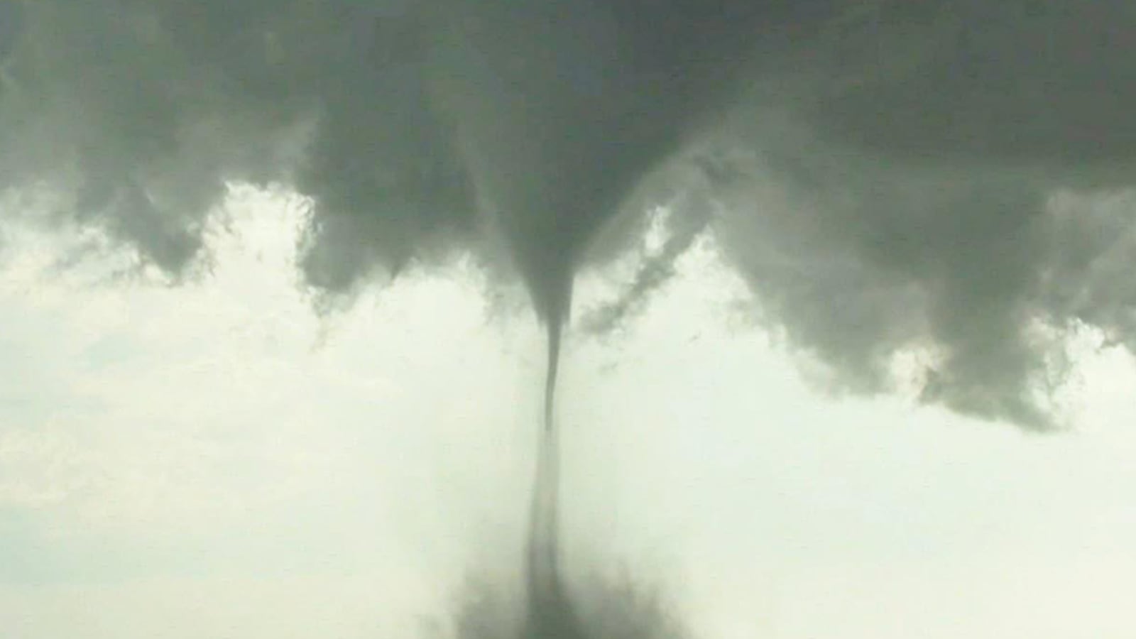
Environment Canada is tracking a severe thunderstorm in eastern Saskatchewan that could be producing a tornado. At 6:01 p.m. Sunday, it issued an alert for a possible tornado near the RM of Churchbridge, which includes the town of Churchbridge and the village of MacNutt. Also in its path are Manitoba communities and areas such as Dropmore, Shellmouth, Inglis and Asessippi Provincial Park. Listed as a red warning, the storm also brings the additional hazards of 90-110 kilometre per hour winds, golf ball to tennis ball-sized hail and heavy rainfall (50-100 millimetres). The storm is moving northeast at about 40 km/h. This is a very dangerous and potentially life-threatening situation, read Environment Canadas alert. Earlier in the dayA tornado watch has been issued for areas in southeast Saskatchewan and into Manitoba. As of 1:09 p.m. Sunday, Environment Canada said conditions are favourable for the development of severe thunderstorms which may produce tornadoes, strong winds, large hail and heavy rain. The watch covers areas including Estevan, Carnduff and Moosomin. Environment Canada said the thunderstorms could bring wind gusts of up to 120 kilometres per hour, hail up to nine centimetres in diameter and rainfall in amounts exceeding 50 millimetres. There is an extreme risk for anyone in the path of these storms if they do develop and move onto the east, northeast, said Keane Kokolsky, meteorologist with the Storm Prediction Centre in Winnipeg. Kokolsky added itll be tricky to predict just how long the watch will be in effect, but said it will likely last well into the evening. It was still in place as of 4:44 p.m. Sunday. A severe weather outbreak is expected today. Multiple thunderstorms will rapidly develop this afternoon along a stalled front over southeastern Saskatchewan and southwestern Manitoba, read Environment Canadas alert. Significant severe weather including tornadoes is probable, continuing into the evening hours. The alert went on to say that significant damage or destruction to homes, infrastructure or the natural environment is possible. In the event of a tornado, or if a tornado warning is issued for your area: go indoors to a room on the lowest floor, away from outside walls and windows, such as a basement, bathroom, stairwell or interior closet, said Environment Canada. 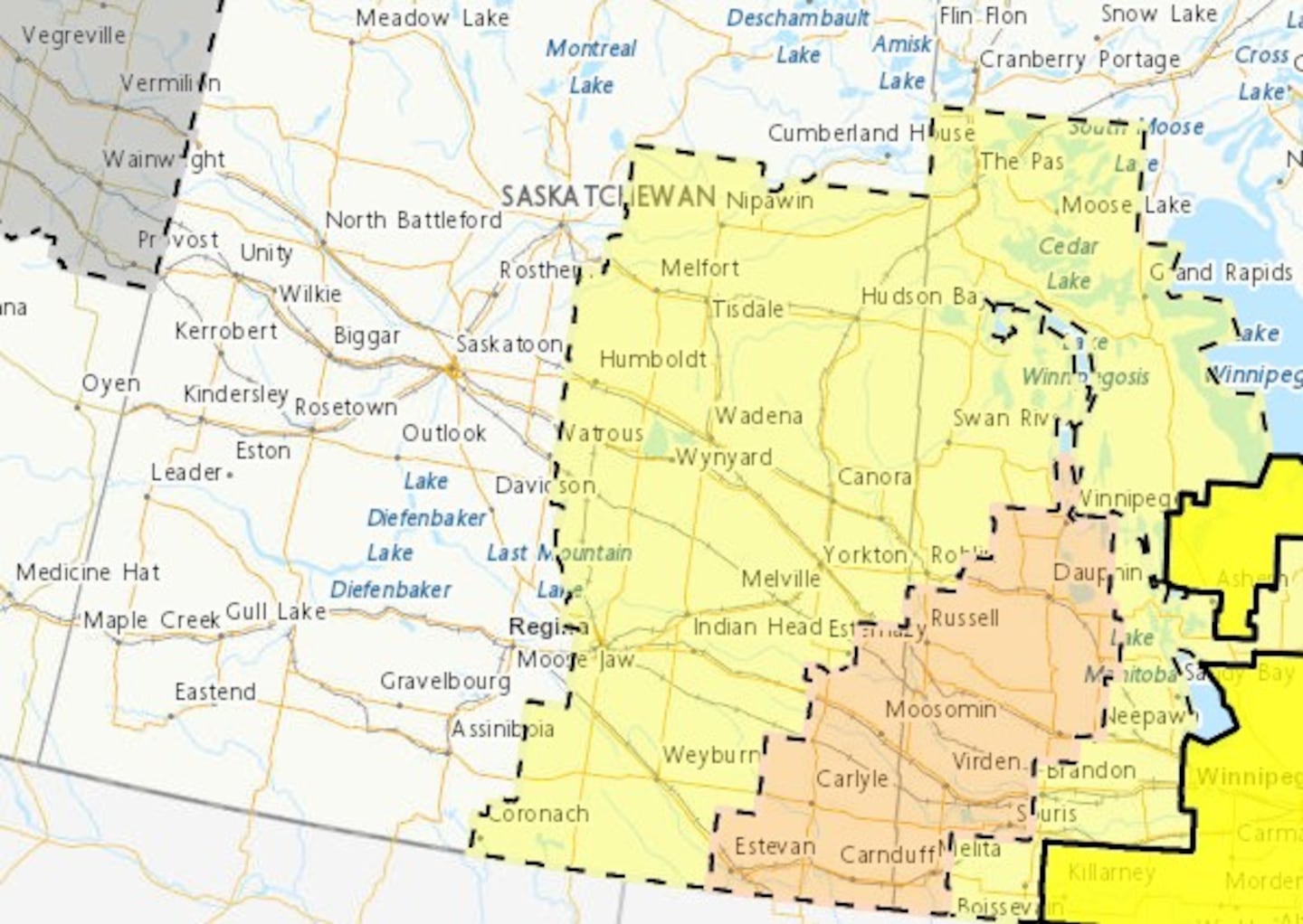
Leave mobile homes, vehicles, tents, trailers and other temporary or free-standing shelter, and move to a strong building if you can. As a last resort, lie in a low spot and protect your head from flying debris. Be prepared for severe weather. If you hear a roaring sound or see a funnel cloud, swirling debris near the ground, flying debris, or any threatening weather approaching, take cover immediately. Environment Canada also cautioned those out on water to be vigilant and to prepare for severe weather. Should they be faced with threatening weather, they are urged to make for sure and take shelter immediately. Severe thunderstorm watchEnvironment Canada also placed a good chunk of southern, central and eastern and east-central Saskatchewan under a severe thunderstorm watch. As of 1:08 p.m., it covers areas as south as Coronach, Estevan and Carnduff and reaches areas as far north as Nipawin. Regina is also included in its range. The alert carries the risk of wind gusts up to 100 km/h and hail up to 4 centimetres in diameter. Isolated severe thunderstorms will form over portions of Saskatchewan west of a stalled weather front by the Manitoba border. These thunderstorms will be faster moving and mainly present a hazard of strong to severe wind gusts along with hail, read Environment Canadas alert. The watch was still in effect as of 4 p.m. Sunday. Though its difficult to say how long the watch will last, Kokolsky said it would be in place at least until around midnight.
|